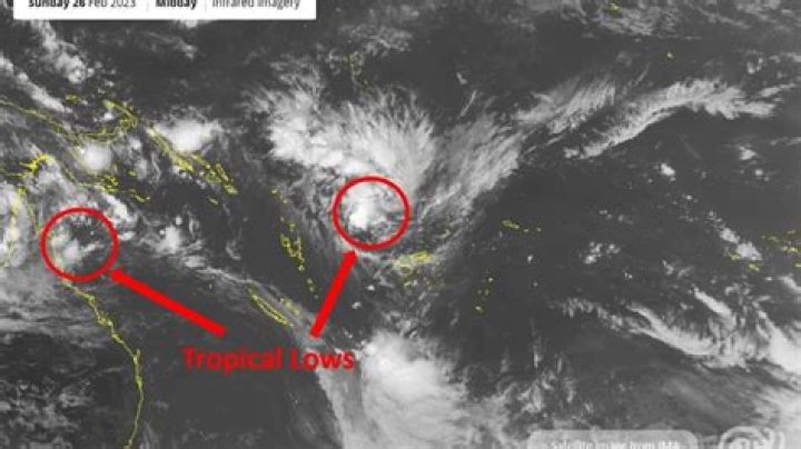
Meteorologists say a pair of tropical cyclones may form in the South Pacific next week, with a potential risk of more rain and swells for eastern parts of New Zealand.
However, the threat of another direct hit on the country is considered low at this stage.
MetService meteorologist Stephen Glassey said a tropical low moving westward toward Vanuatu this afternoon was likely to develop into a tropical cyclone early this week.
“It should then curve southeast and move out of the tropics later in the week,” he said.
AdvertisementAdvertise with NZME.“At this stage, the risk of it directly impacting New Zealand after it leaves the tropics is relatively low as it should track to the northeast of us in about a weeks’ time.”
However, he said, indirect impacts such as rain and large swells for eastern areas were more likely.
“There is still a lot to happen before the track becomes more certain so things could change,” he said.
Potentially 2 tropical cyclones developing this week. At this stage, the risk of either directly impacting New Zealand is relatively low. However, there is a lot to happen before the tracks becomes certain so things could change. is updated daily. ^SG
— MetService (@MetService) February 26, 2023
“There is also another low in the Coral Sea that has an increased risk of developing into a tropical cyclone later in the week and could follow a similar path.”
AdvertisementAdvertise with NZME.MetService meteorologist John Law also said there was currently a “relatively low risk” of direct impacts on New Zealand.
“It’s worth saying though, that it’s still a long way on the horizon and there’s a lot of uncertainty in how things will pan out,” he said.
“Because there is a lot of uncertainty, things can change as we head through the next few days.”
Law expected to have a clearer picture of any potential risk to New Zealand by mid-week.
Glassey said we were currently near the historical peak of the cyclone season, “so it is not unusual for tropical cyclones to develop this time of year”.
We're near the historical peak of the cyclone season, with a new TC brewing NW of Fiji.
The developing low is forecast to deepen on approach to Vanuatu tomorrow.
Most models show Vanuatu impacts Tue/Wed, curve out of Tropics to SE on Thu.
— chrisnoble_nz (@chrisnoble_nz) February 25, 2023
Historically, late February and early March marked the height of our November-to-April cyclone season.
In a given week around this peak period, chances of a cyclone being present in the southwest Pacific was typically at least 50 per cent.
Each season, around nine cyclones formed up in the southwest Pacific, of which least one travelled within 550km of our country.
But this season had come with an elevated risk, with Niwa warning at its outset that one to two systems could head our way – as had since come to pass with Gabrielle and Hale.
As the tropics become more active, we also need to focus on rain that's forecast over the next 36 hours.
Low pressure well to our northeast will result in moist onshore winds & rain for the upper/east of the North Island.
For some, rain may be heavy.
— NIWA Weather (@NiwaWeather) February 26, 2023
Much of that could be explained by the current state of our tropical ocean waters.
AdvertisementAdvertise with NZME.“We are currently in a La Niña phase, which is conducive to tropical cyclones forming in and around the Coral Sea near Vanuatu and New Caledonia,” MetService meteorologist Lisa Murray explained in a blog post this month.
“This is a breeding ground for many of the cyclones that have impacted Aotearoa New Zealand historically.”
While La Niña was likely to fade to a “neutral” climate state over the next month, Murray said there wouldn’t be a tangible change to our weather maps through the rest of summer, given the atmosphere essentially had to “catch up”.
A sharp reduction in trade wind strength (🔴) is expected in early March...
For La Niña, this will be the straw that breaks the camel's back, likely spelling an end to the memorable "triple dip" episode of 2020-2023.
— Ben Noll (@BenNollWeather) February 25, 2023
Meanwhile, forecasters were picking the potential for big rain-makers around the first week or two of March – owing not to cyclone risk, but another more frequent occurrence in our climate system.
That was the Madden Julian Oscillation (MJO) – a pulse of rain and thunderstorms that circled the globe every 30 to 60 days – passing above New Zealand over that period.
The historic storm that brought Auckland’s wettest day on January 27 happened to coincide with a visiting MJO - but its influence on New Zealand still depended on there being local low-pressure systems to ferry that subtropical moisture down here.
AdvertisementAdvertise with NZME.